Hiking in Chamonix: the finest walks, by real difficulty, with the useful lifts
Chamonix is a great hiking destination, not an easy one by default. Routes ranked by real difficulty, from family strolls to mountain traverses, the lifts that save you the climb, what suits families, and mountain safety.
Chamonix is one of the great hiking destinations in the Alps, but not an easy one by default. The routes behind its reputation, from Lac Blanc to the Grand Balcon Nord, combine height gain, rocky sections, late snow patches and heavy foot traffic; the lifts save you the climb, not the risks.
Rather than ranking trails by popularity, this page ranks them by real difficulty: family strolls, accessible panoramic hikes, sporty classics and mountain traverses. With, for each one, the lift that helps and what it costs.
The huts where you can stop, or sleep, are on the map with their altitude and season. Tap a number for the listing.
Our tip: Start early and aim to be back before 3pm in summer: storms often build in the afternoon in the mountains, and the last cabin waits for no one.
What are the finest hikes in Chamonix?
| Route | Level | Distance | Height gain | Duration | Useful lift |
|---|---|---|---|---|---|
| Lac Bleu from the Plan de l'Aiguille | easy | 1.3 km return | +60 m | 45 min to 1 hr | Aiguille du Midi cable car |
| Gaillands lakes | easy | 2 to 4 km | minimal | 1 hr to 1 hr 30 min | none |
| Bérard waterfall | easy to moderate | 4 to 6 km | +200 to +300 m | 2 to 3 hr | train depending on the start |
| Merlet trails | easy to moderate | 2 to 5 km | minimal to moderate | 2 to 4 hr | road shuttle |
| Grand Balcon Sud | moderate | 8 to 12 km | +300 to +600 m depending on direction | 3 to 5 hr | Planpraz, La Flégère |
| Lac Blanc from the Index | moderate to hard | 5 to 7 km return | +350 to +500 m | 2 hr 30 min to 4 hr | La Flégère and the Index |
| Aiguillette des Posettes | moderate to hard | 8 to 10 km | +600 to +800 m | 3 hr 30 min to 5 hr | Charamillon if open |
| Chéserys lakes | hard | 8 to 12 km | +600 to +800 m | 4 to 6 hr | the Index for the high version |
| Grand Balcon Nord, Plan de l'Aiguille to Montenvers | hard | 10 to 12 km | traverse with ups and downs | 4 to 6 hr | Aiguille du Midi on the way out, Montenvers train back |
Distances and height gains are rough figures taken from the tourist office's pages and map surveys: they vary with the variant, the starting point and whether you return by lift. Only Lac Bleu has an official page with figures: 1.3 kilometres, a high point at 2,299 metres and 60 metres of ascent. Durations are never guaranteed: a family, a heavily loaded group or a walker who is not acclimatised will take longer.
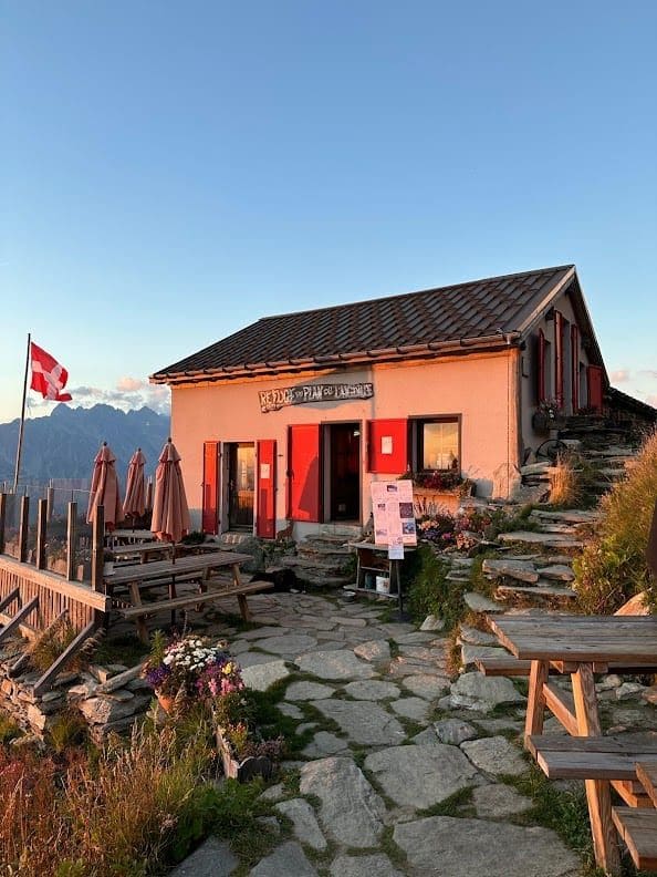
Plan de l'Aiguille hut★ 4.7 · 488 reviews
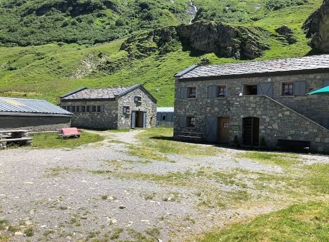
Bellachat hut★ 3.3 · 367 reviews
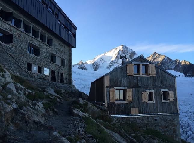
Albert 1er hut★ 4.5 · 356 reviews
Which walks suit families?
Genuine family walks are few, and no high-altitude hike should be chosen just because it is labelled "family-friendly": leftover snow, wind, exposure and the children's ages change everything.
| Outing | Children | Pushchair | Minimum gear |
|---|---|---|---|
| Gaillands lakes | yes | often possible on the laid-out sections | closed shoes |
| Bérard waterfall | yes, if they are used to walking | no | grippy soles |
| Lac Bleu | yes, depending on age and weather | no | hiking boots, water |
| Merlet | yes | limited on the trails | closed shoes |
| Lac Blanc | with children used to walking, often from 7 or 8 | no | boots, warm clothes, poles |
| Grand Balcon Nord | better for teenagers | no | hiking boots, waterproof |
The Gaillands are the simplest outing, free and with no lift, beside the lakes south of the centre. The Bérard waterfall, shady and damp, is often more reliable than a summit: easy, but slippery, and not for a pushchair. The Merlet park combines mountain animals and a panorama for half a day, more pleasant in the morning.
Is Lac Bleu the best view for the least effort?
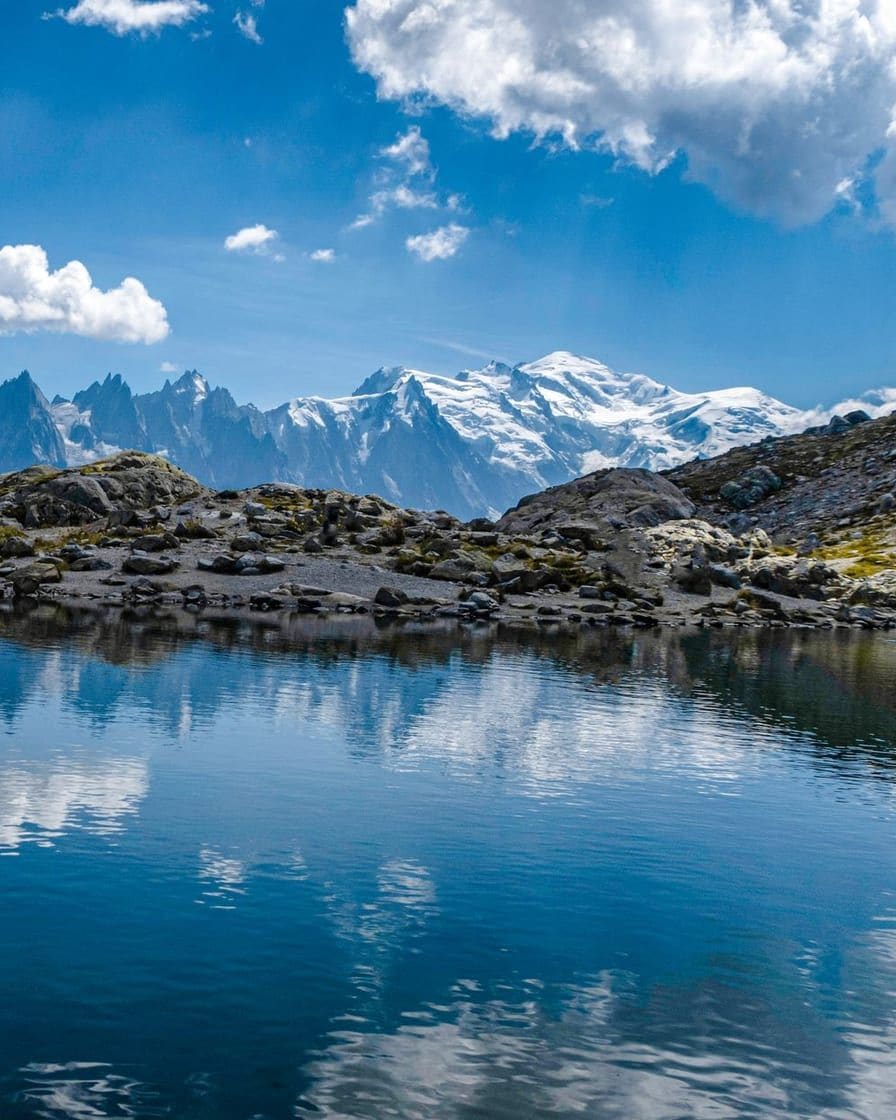
Yes, with conditions. From the Plan de l'Aiguille, the Lac Bleu loop gives you a high-mountain landscape for a modest effort: 45 minutes to an hour, one to two hours on site. It is a very good choice with children who can walk on uneven ground.
Its weakness is its dependence on the Aiguille du Midi cable car: a breakdown, wind or a queue can upset the day. The return trip to the Plan de l'Aiguille costs €43 for an adult in 2026, and the altitude, around 2,300 metres, can tire anyone arriving from the lowlands. See the Aiguille du Midi.
How do you get Lac Blanc right?
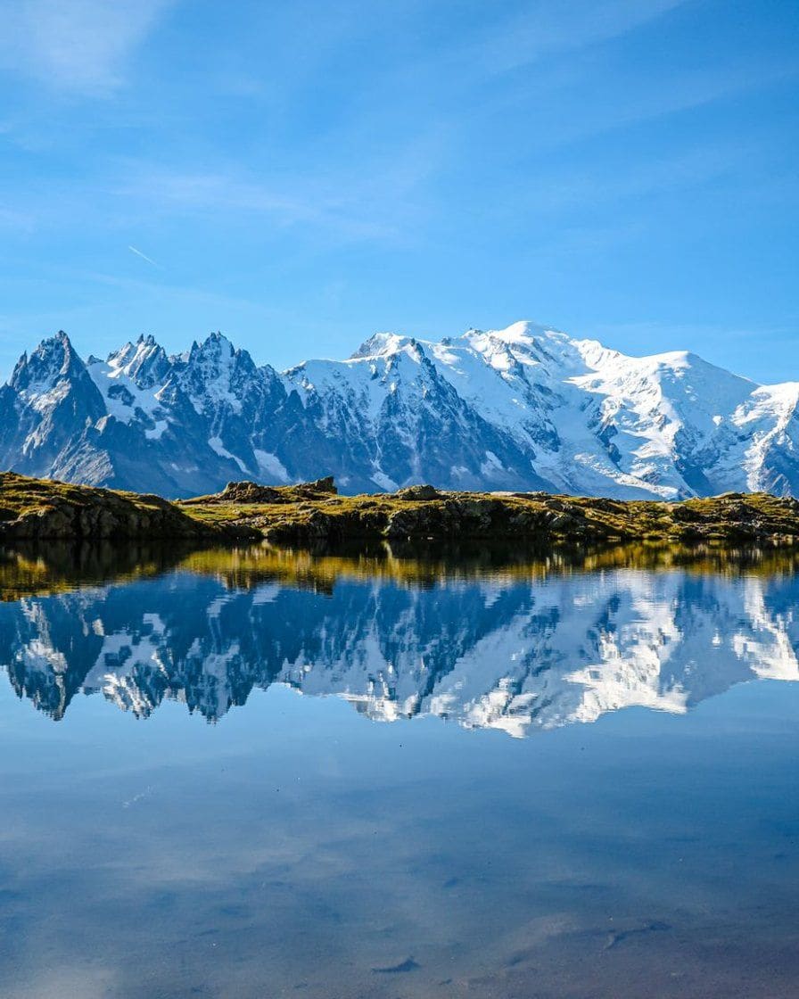
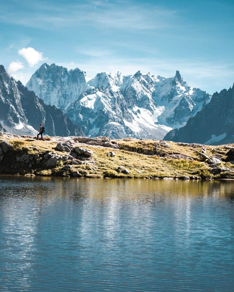
Lac Blanc is Chamonix's signature panorama: the Grandes Jorasses, the Aiguille Verte, the Drus and the whole massif. From the Index, the height gain stays reasonable, but the path is made of rocks, natural steps and sometimes exposed sections.
Snow patches early in the season can call for good boots, poles and sometimes microspikes. And the lake is often packed from late morning to mid-afternoon: take the first cabin, or go up after the big wave.
The gondola from Les Praz to La Flégère costs €25 return, and the combined ticket to the Index €43. Opening times and the season's reopening are in our page on La Flégère.
Hike with a guide? Guided outings to the lakes, supervised glacier walks, paragliding to come down another way: our partner's Chamonix page gathers the available activities, with levels and cancellation terms shown.
See guided hikes in Chamonix →Partner link: booking through it supports the site at no extra cost to you.The grand balcony trails: for what level?
The Grand Balcon Nord, from the Plan de l'Aiguille to Montenvers, is one of the finest panoramic hikes in the valley, and one of the most poorly presented to beginners. It is a long, uneven mountain traverse with big variations in snow: moderate to hard depending on conditions, better suited to teenagers used to hiking.
Its trap is logistical: you need two lifts, the Aiguille du Midi on the way out and the Montenvers train on the way back. Reaching Montenvers after the last train means adding the walk down to Chamonix. The return is made with the single ticket at €26.50, see the Montenvers train.
The Grand Balcon Sud, around Planpraz and La Flégère, often gives a better experience than the viewing platforms: constant views of Mont Blanc, and several lifts to shorten it. The full traverse is not a short stroll, and snow patches linger there. See Le Brévent.
Which lifts should you use, and how much do they cost?
| Lift | For which hikes | 2026 adult return |
|---|---|---|
| Cable car to the Plan de l'Aiguille | Lac Bleu, Grand Balcon Nord | €43 |
| Montenvers train | Mer de Glace, return from the Balcon Nord | €31.50, single €26.50 |
| Flégère gondola | Lac Blanc, Balcon Sud | €25 |
| Planpraz gondola | Balcon Sud, Brévent | €25 |
| Charamillon gondola | Aiguillette des Posettes, Le Tour area | €25 |
The hiker ticket, a return on one section and a single on the other, costs €33. For several days of walking, pedestrian passes start at €119 for two days: they become worthwhile as soon as you string together expensive lifts. Buy from the official ticket offices: a reseller's "skip-the-line" ticket guarantees nothing if the lift closes.
No free first Sunday of the month applies to the lifts, Montenvers, the Aiguille du Midi or Merlet. Each lift's closing dates are in lift opening dates.
Do you need to book anything?
The trails, no. But the lift that takes you there may require a time slot: the Aiguille du Midi should be booked in July, August and on sunny weekends, see Aiguille du Midi tickets. The Montenvers train should be booked at busy times.
A night in a mountain hut is booked directly with the hut, sometimes weeks or months ahead for summer weekends. No availability list is published: confirm before setting off, and remember that a hut is not a guaranteed emergency shelter.
How do you hike safely in Chamonix?
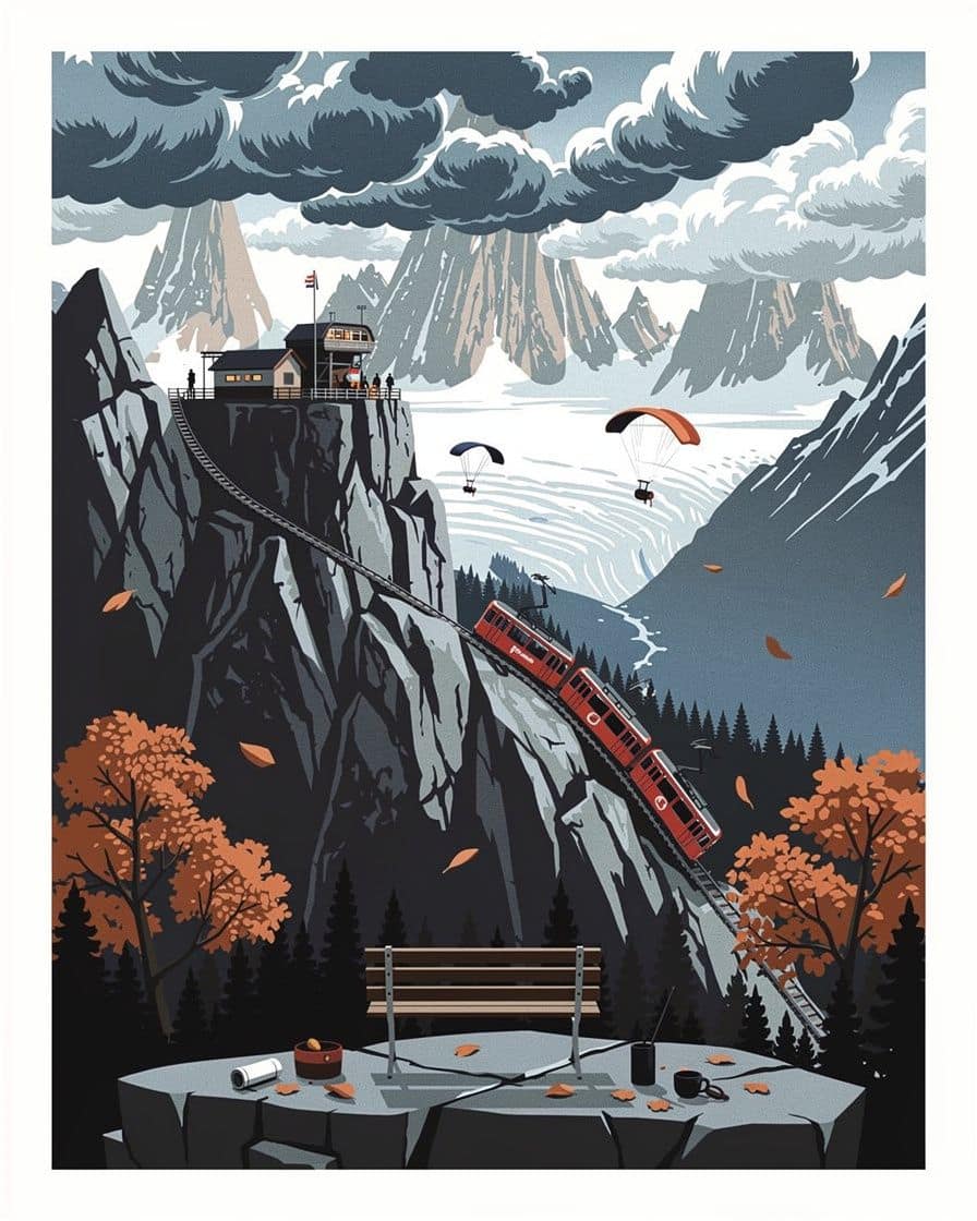
The tourist office recommends checking the weather, telling someone your route and return time, and setting off with sturdy boots, warm and waterproof clothing, a small first-aid kit, sunglasses and sunscreen. In June, snow lingers at altitude: a summer route page does not mean a dry trail.
At the first rumble of thunder, leave the ridges and exposed areas, give up on the lake or the col even if it is close, avoid isolated trees and posts, and keep a margin to come down before the last lift. Summer afternoons are less favourable for high routes.
The numbers to save:
- 112, the European emergency number; 15 for the SAMU medical service, 18 for the fire brigade;
- Chamonix PGHM, the mountain rescue service: 04 50 53 16 89, according to the tourist office;
- Office de Haute Montagne, for route conditions: 04 50 53 22 08, generally from 9am to noon and 3pm to 6pm in summer.
An offline map and a paper map are still useful: there is no signal in some areas. The full list of emergency services is in practical services in Chamonix.
When should you hike, and how much time should you allow?
From June to September, with September as the best compromise: fewer people, conditions still good, but lifts that close during the month. The month-by-month details are in when to go to Chamonix.
| Outing | Realistic time | Best moment |
|---|---|---|
| Lac Bleu | 1 to 2 hr on site | early morning or late afternoon |
| Lac Blanc | 4 to 7 hr with transport | early start |
| Mer de Glace | 3 to 5 hr | first train |
| Grand Balcon Nord | 5 to 8 hr with transfers | very early start |
| Grand Balcon Sud | 4 to 6 hr | morning, before the storms |
The downsides the brochures play down
- The crowds. Lac Blanc, the Aiguille du Midi, Montenvers and La Flégère are packed in the middle of the day in August; the official photos are taken early.
- The costs. Parking, local transport, mountain meals, huts and gear bought on site come on top of the lift.
- Closures. A site can be open while the trail linked to it is impassable, and the end of service decides any one-way traverse.
- The Mer de Glace. Montenvers is a visit more than a hike, and the ice cave means a long staircase, see the Mer de Glace.
Other outings are in things to do in Chamonix and the What to do section. The trails and lift departures are placed on the map of Chamonix.
For hiking, stay at the foot of the trails: in Les Praz, La Flégère gondola, the gateway to Lac Blanc, is within walking distance, and the train takes you back to central Chamonix in a few minutes.
See places to stay in Les Praz-de-Chamonix →Partner link: booking through it supports the site at no extra cost to you.Sources
Sources: Chamonix Tourist Office (hiking pages, including Lac Bleu, ranking of easy and sporty routes, mountain safety advice), Office de Haute Montagne (contact and hours), Compagnie du Mont-Blanc and tourist office (2026 pedestrian fares for the Aiguille du Midi, Montenvers, La Flégère, Planpraz and Charamillon), map surveys of the routes.
Apart from Lac Bleu, distances, height gains and durations are rough figures that vary with the variant; no hut availability list is published. Research carried out on 27 October 2026, after the end of the summer 2026 season: the state of the trails in 2027 should be checked before setting off.
Frequently asked questions
What is the most beautiful hike in Chamonix?
What easy hike can you do in Chamonix?
How long does the Lac Blanc hike take?
What number should you call after a mountain accident in Chamonix?
Can you go hiking in Chamonix with children?
Thibault Ravanel
Thibault led groups along the south balcony trails for eight summers, from Le Brévent to La Flégère. He builds his routes stopwatch in hand and cuts whatever does not fit into a real day. He would rather write that an outing is not worth the ticket than pad out a list.